The release of the public beta version of Lightroom 4 last week generated huge amounts of coverage in the blogosphere, and for good reason: the next release of LR will include significant new features such as soft-proofing, improved shadow and highlight detail recovery, book generation (courtesy of Blurb) and mapping.
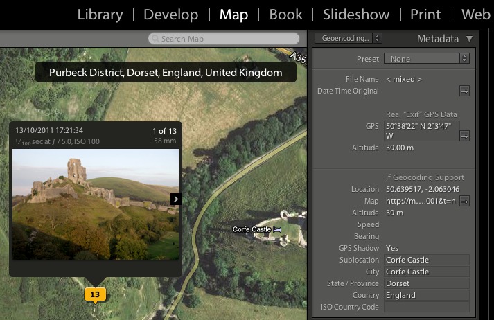
I am particularly pleased about this last feature, as Lightroom has not allowed write-access to the GPS metadata field until now. Beforehand, the best choice for users who wished to store geo-location data with their Lightroom images was to use Jeffrey Friedl’s extremely useful geotagging plugin for Lightroom, which I have used for the last two years. This multi-featured applet not only attaches latitude and logtitude information to an image, but can also reverse geoencode, that is, fill in the Location, City, Region and Country information in the EXIF data from the coordinates.
However, as Lightroom couldn’t write to the true GPS metadata field, Jeffrey’s plugin had to make do with storing location data in a temporary ‘GPS Shadow’ field; the location data could then be ‘injected’ into the EXIF data of a file only on export.
So much for the background. The reason that I am a happy man is that, having originally that thought I would have to somehow re-do over 7,000 geo-encoded images, I have just discovered that Jeffrey Friedl will be providing a means for converting the old GPS shadow data to the ‘real’ GPS field. Hallelujah!
Why not pop over to Jeffrey’s blog and read the news for yourself , and if you are interested in geotagging your images then do take a look at his plugin (I have no commercial link or interest in Jeffrey’s plugin apart from being a satisfied customer).

Leave a Reply